Mapping our Present, Preparing for our Future: Mark Masoner and True North Mapping and Solutions
September 23, 2023 by Jessika Leatherbury
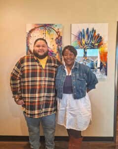
By: Sunnie Dawn Baker

In 2010, Mark Masoner was working as a paraprofessional at Homer Elementary when he saw a BrainPOP cartoon about George Washington surveying the west. The cartoon stuck in his brain and he thought, “I want to do something like that.” Masoner had taken several college courses before, but never finished his degree. He had one child, another on the way, and he was determined to finish his education. And the cartoon about George Washington gave him his direction. He went back to East Central University and two years later, when he was 27, he had his degree in Cartography and Geography with a focus in Geographic Information Systems (GIS).
During his coursework, Masoner had the chance to experience many different applications of GIS technology. He interned for the Chickasaw Nation and an oil and gas company. For his capstone project, he worked with the City of Ada doing a drive time analysis for the upcoming new fire station. He received accolades for this project at a research contest at the state capitol, and he also caught the attention of the City of Ada. After graduation, Masoner worked for an oil and gas company for only two months before the City of Ada approached him with an offer to build their GIS program from scratch. He started out as a coordinator and then within a year and a half was a division head.
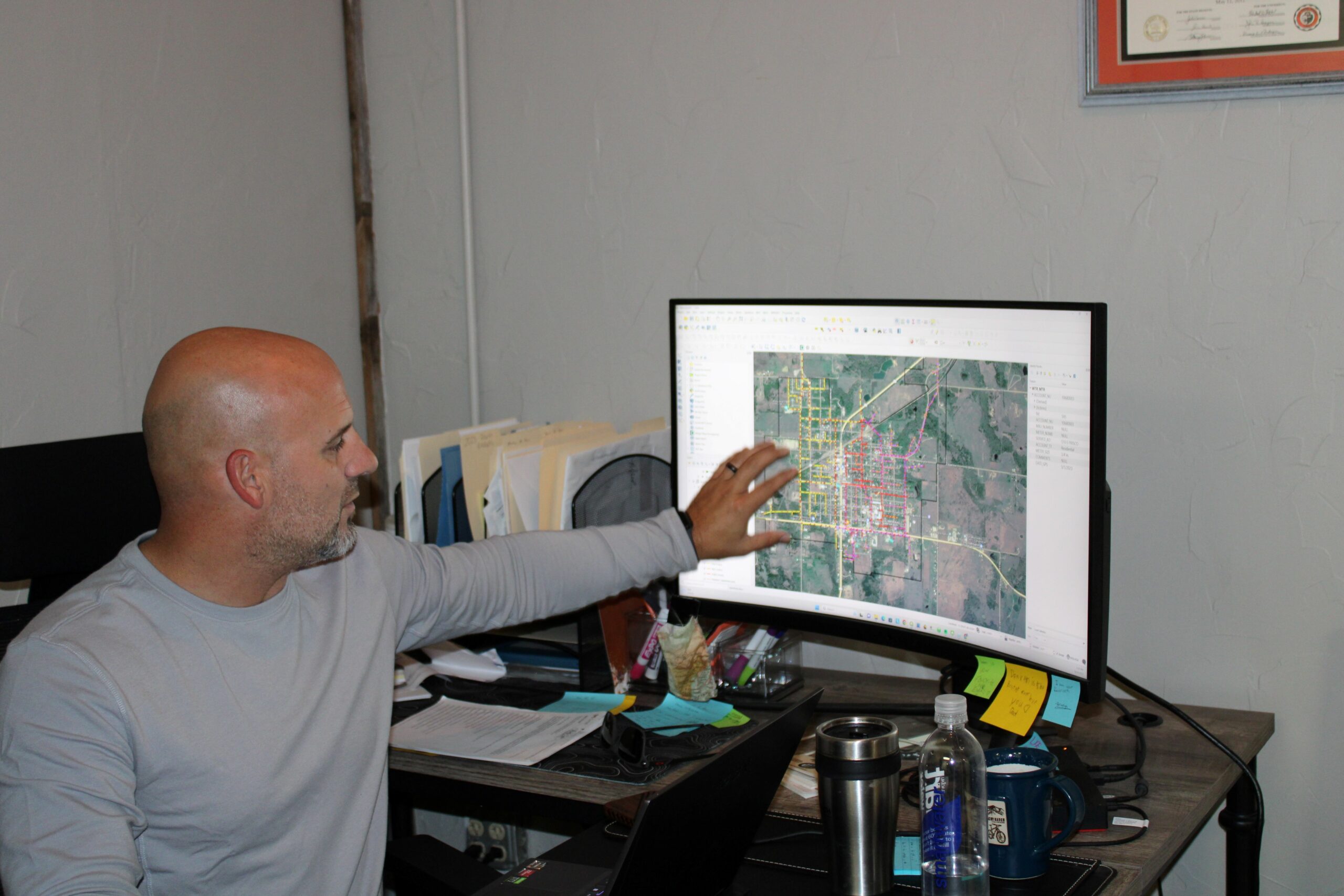
GIS software has become a crucial element for towns and cities. The application of GIS is more than just making maps, but tying these geographic points on maps to information, such as the tax roll information for a piece of property. This is the information part to accompany the geography, and more than just roads and properties, it also includes electric lines, water infrastructure, and even cemetery plots. Cities use this up-to-date geographic database to carry out their day-to-day work, from planning and zoning to utility locations for public works. Emergency services can use the information to respond more quickly in a crisis, and cities use GIS to enhance our overall quality of life.
Despite these advantages, a key issue for GIS departments is the high cost of the software used to manage and map this information. As this function becomes more of a necessity than a luxury, many small towns simply cannot afford to have their own GIS department. Masoner knew how much these small towns needed this information and saw an opportunity to start his own business while also helping other communities. Four years ago, Masoner approached other towns in Oklahoma, offering to provide GIS services for them. Instead of hiring an entire GIS department, they could use him and his company, True North Mapping and Solutions, to do the work for them. The first two towns that took him up were Kiowa and Marlow and they are still with him today.
As Masoner grew his business, he was still working full time for the City of Ada, and much of his work had to be done in the evenings or on the weekends. However, Masoner wanted to be able to spend more time with his wife and children, and, in April of 2023, he left the City of Ada to become a full-time entrepreneur. Masoner says, “I was torn about leaving versus trying to stay at the city. They gave me my shot and I am loyal.” However, once he did decide to be a full-time entrepreneur, the business took off. In the beginning, it was just Masoner, but now he has expanded to include his wife, Abranda, doing payroll, his brother, Joel, as a project manager, a Lead GIS Analyst, and then five other part-time employees that go out and collect the data necessary to build the maps. This expansion was necessary because while Masoner started with two cities, his business has now grown to serve twenty-seven different towns and cities and he is anticipating three more by the end of September.
One of Masoner’s biggest challenges is pitching to these towns for the need for GIS. Typically, there might be one person who has all the institutional knowledge of where key information is located within the city. However, when this key individual retires or leaves, all of this critical information could be lost. By bringing Masoner and True North on board, they receive what he calls “turnover insurance.” They don’t have to worry about all of the information being in one person’s brain because it is all mapped out, nice and neat, in a digital format that can be updated as necessary. Each customer gets an iPad with all of their GIS information on it that they can easily access whenever they need to.
Maps tell stories about who we are as a people. They make sense of the world that we live in and give us a way to navigate our spaces, but also to envision them. Masoner has contracts with bigger cities like Bartlesville, El Reno, and Ada, but also small towns like Kiowa and Marlow. No matter the size, the need is there, and Masoner wants to be the one to help in a way that is affordable to each location. Our world is changing, our maps are changing, and Mark Masoner is here to document it all.
Sign up to receive more news from the Ada Jobs Foundation HERE!
Written by

Jessika Leatherbury
You may also interested in:

BUILDING FUTURES: WORK READY ADA CELEBRATES ITS FIRST YEAR
BY: CATHLENA SPENCER Just one year ago, Work Ready Ada, a new employment readiness program, was launched in partnership with Pontotoc Technology Center (PTC). The program, funded by Oklahoma Human
AI IN EDUCATION: A CONVERSATION WITH VINAYAK MITTY
BY: SUNNIE DAWN BAKER One of the areas in technology with the most potential for entrepreneurial growth is Artificial Intelligence (AI). AI is increasingly shaping every part of our lives,
Adapt and Overcome: Allison Poe’s Recipe for Resilience and Growth
By: Sunnie Dawn Baker Allison Poe has always followed her feet. She waits for the signs to appear and, once she recognizes them, she travels that path, and has never
Jeff Warren: A Life in Sound, Vision, and Storytelling
By: Sunnie Dawn Baker When Jeff Warren got involved in the Houston music scene as a teenager, he had no clue where his path would lead. Now, nearly thirty years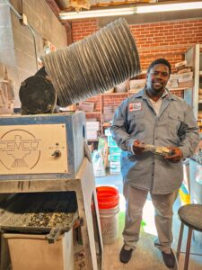
From Pitch to Progress: ECU's Glass Recycling Program Turns Waste into Opportunity
By: Sunnie Dawn Baker In 2018, Dr. Christine Pappas competed in Ada Jobs Foundation’s Big Pitch Competition by promoting grinding glass bottles into sand. She won the Big Pitch that
The Importance of Customer Discovery: Know Your Audience and Know Your Market
By: Sunnie Dawn Baker Entrepreneurs and small business owners must consider many factors to achieve success, with their target market being one of the most crucial. Sometimes, when people are
What Does Economic Development Do for You? The Significance of the Economic Multiplier
By: Sunnie Dawn Baker People often find the term “economic development” vague and confusing. Understanding how economic development works and benefits the community can be challenging. Though there are many
Helping Entrepreneurs One Workshop at a Time: Lauri Rowe and QuickBooks for Small Businesses
Entrepreneurs tend to be filled with passion and big ideas. They have found a solution to a problem they see in the world, and they barrel ahead, excited for their
Hunter Cook: Technology, Entrepreneurship, and the Written Word
By: Sunnie Dawn Baker Hunter Cook started writing when he was seven years old. At first, he wanted to write comic books, but then he realized he couldn’t draw. He